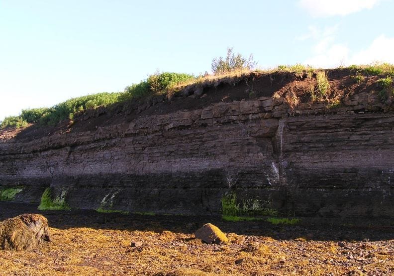
The Fossvogsbakkar protected area extends along approximately 2 km of coastline, from the innermost part of Fossvogur, where the municipal boundaries of Reykjavík and Kópavogur meet, westwards to a point 5 metres from the outfall pipe of Reykjavík District Heating in Nauthólsvík.
The best vehicle access is from Nauthólsvegur in the west and Suðurhlíð in the east. Walking paths also lead down to the area from Öskjuhlíð and Fossvogur Cemetery to the north. Part of the walking and cycling path that runs east to west along Skerjafjörður lies within the protected area.
The geological layers are best explored at low tide, when visitors can walk down into Fossvogur for a closer look. They are also clearly visible from the top of the cliffs, but visitors should take care not to stand too close to the edge, as coastal erosion has made the sedimentary cliffs unstable in many places.
Access and Information
Protection Status
Fossvogsbakkar was designated a natural monument in 1999. The area contains the Fossvogur Beds, rare geological formations that provide an important record of the geological history of Reykjavík and Iceland as a whole. Protecting these formations is the primary conservation value of the area.
Natural monuments are protected natural features considered important because of their scientific value, beauty or distinctive character. The purpose of the designation is to protect the rare geological formations found at Fossvogsbakkar.